
Why Property Corners Are Not Always Where Homeowners Expect
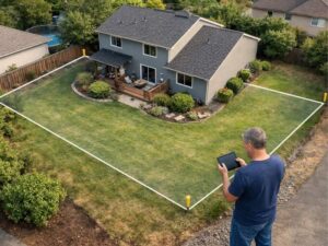
Most homeowners think they know where their property ends. They look at the fence. They look at where the neighbor’s driveway starts. They make an assumption and move on.
That assumption is wrong more often than anyone expects.
A property boundary survey regularly turns up corners that sit nowhere near where the owner thought they were. Sometimes it’s a few inches. Sometimes it’s several feet. Either way, it creates real problems for developers who are counting on accurate site dimensions before breaking ground.
Here’s why it happens and what actually determines where a property corner sits.
Why Straight Fences and Driveways Create False Assumptions
Fences look official. A long straight fence running along the back of a yard feels like a boundary. It probably was installed with that intention. But a fence is only as accurate as the person who put it in.
Most residential fences were installed without a survey. A homeowner measured from a visible marker, made a guess, or matched where the neighbor’s fence ended. That’s not a property boundary. That’s a guess with permanent materials attached to it.
Driveways cause the same problem. A concrete driveway poured along the side of a property tends to look like it follows the lot line. In reality, it follows whatever the contractor thought looked right on the day it was poured.
Subdivision layouts make this worse. Many older neighborhoods were platted with lot lines that run at angles. Those angles aren’t obvious from street level. Two lots may share a boundary that cuts slightly diagonal, yet both owners built their fences in straight parallel lines. When a property boundary survey is done, neither fence lines up with the actual lot corner.
How Landscaping Can Hide Original Boundary Evidence
Corner monuments are the physical markers that surveyors set to mark lot corners. In Florida, these are typically iron pins or rebar driven into the ground. They’re small. They’re easy to miss. And they’re very easy to bury.
Fifteen years of yard work can cover a corner pin completely. Flower beds get expanded. Sod gets relaid. Retaining walls go up right where a marker used to be visible. By the time a developer buys the property, there may be no visible marker at any corner.
When markers are gone, homeowners fill the gap with whatever looks logical. The edge of a flower bed. The end of a mulch line. A tree that seems to sit on the edge of the yard. None of those are property corners. They’re yard features that happen to be near the boundary.
Licensed surveyors don’t rely on visible markers alone. They work from recorded plat data and measurements to calculate where the corner should be. Then they search for buried evidence to confirm it. That process often turns up corners well outside the area a homeowner assumed.
Why Neighboring Structures Do Not Define Property Lines
This situation comes up all the time. A homeowner points to their neighbor’s shed, which sits about ten feet from the shared fence line, and says the property line must be right there. The logic feels solid. The shed was built with a permit. It had to meet setback rules. So the line must be where the setback was measured from.
That logic doesn’t hold.
Setback measurements are only as accurate as what the permit applicant provided. If they measured from a fence rather than from the actual boundary, the shed could sit in a place that has nothing to do with the real property line. A permit doesn’t guarantee the measurements came from accurate corner locations.
Pools and home additions have the same issue. They’re common in Pembroke Pines, and they’re frequently built based on estimated property lines. A developer who uses neighboring structures to estimate lot dimensions is building on someone else’s guess.
Why Curved Streets and Irregular Lots Make Corners Hard to Find
Pembroke Pines has many lot shapes that don’t behave the way owners expect. Cul-de-sacs, corner lots, waterfront parcels, and older subdivisions can have boundaries that look very different on paper than they do in person.
A cul-de-sac lot has a curved front boundary that follows the arc of the street. The rear of the lot may be much wider or narrower than the front. From the ground, it’s hard to tell where the side lot lines are because they fan out at angles. Property corners on these lots often end up further into what homeowners assume is common area, or further into what they think is their own yard.
Waterfront parcels Pines add another layer. When a lot sits next to a canal or lake, the boundary may be tied to a specific reference line near the water’s edge. The actual corner can sit in a place that surprises even experienced property owners.
Corner lots are another problem. An owner on a corner may see two street-facing boundaries defined by curbs. But the rear corners often sit in places that don’t match what the owner expects from looking at the yard.
All of these lot types need a boundary survey before any construction begins.
What Surveyors Use to Locate Property Corners Accurately
Surveyors don’t estimate. They calculate.
The starting point is the recorded plat for the subdivision. That document has the official dimensions of every lot, the angles of every lot line, and the locations of control monuments set when the subdivision was first laid out. A licensed surveyor uses that data to compute where each corner should be.
Then they go to the field. They locate the original control monuments, take measurements, and work toward the lot corners using the recorded dimensions. When they reach a corner location, they search for physical evidence: a buried iron pin, an old pipe, any marker set by a prior surveyor.
If evidence exists and matches the calculations, the corner is confirmed. If monuments are missing, the surveyor sets a new one based on the recorded data and field measurements.
Modern GPS equipment has made this process faster. But the method stays the same. Surveyors work from recorded legal data, not from fences or landscaping.
For developers, the point is simple. Don’t trust what the yard looks like. Trust a licensed surveyor with the right tools and the right records.
Frequently Asked Questions
Can I find my property corners without hiring a surveyor?
You can look for visible monuments above ground, but you shouldn’t rely on that for construction or development decisions. Corner pins get buried, moved, or destroyed. A licensed land surveyor uses recorded plat data and field measurements to confirm corner locations. For any development project in Pembroke Pines, a professional survey is required.
What if my neighbor and I agreed on where the property line is?
A verbal agreement doesn’t change the recorded legal boundary. Florida allows written boundary line agreements to be recorded in the public record, but informal agreements carry no legal weight in a permit application or real estate transaction. Only a recorded document or a court order can change a legal property line.
How does a surveyor re-establish a corner if the original monument is gone?
The surveyor uses the recorded subdivision plat, measurements from nearby control monuments, and any remaining physical evidence to calculate where the corner should be. They then set a new monument at that location.
Do all lots in a subdivision have the same shape?
No. Interior lots, corner lots, cul-de-sac lots, and waterfront lots are all laid out differently. The recorded plat shows the actual dimensions and angles for each individual lot. Developers should review the plat before making any assumptions about a property.
What’s the risk of starting construction without confirming property corners?
A structure built over a property line may need to be moved or removed at the owner’s cost. The City of Pembroke Pines requires accurate site plans for permit applications. A plan based on estimated rather than surveyed boundaries can fail review. The cost of a boundary survey before construction is far less than fixing a problem after the slab is poured.
For a free land surveying quote, call us at (954) 737-7509 or send us a message by going here.