
Why Flood Elevation Data Matters After Heavy Rain
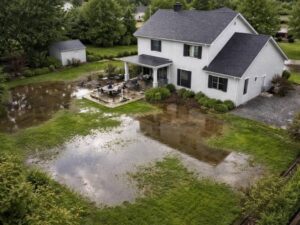
When heavy rain hits, some properties flood and others don’t. The difference usually comes down to one thing: how accurately the site elevation was measured before anything was built. An elevation survey done at the right time gives developers the data they need to make smart decisions about floor heights, drainage and long-term flood risk. Without it, you’re guessing, and in South Florida, guessing is expensive.
What Heavy Rain Actually Exposes
A bad storm doesn’t create flood problems. It reveals them.
Properties that take on water after heavy rain almost always have one thing in common. The elevation data used during design was either wrong, outdated or never confirmed by a licensed surveyor on the actual parcel. A general county map or GIS layer won’t catch a low spot in the middle of a lot. A field survey will.
Pembroke Pines sits in Broward County at a low average elevation. The area is mostly flat, which means small differences in grade matter a lot. A 6-inch difference in finished floor elevation can separate a dry building from one that floods during a routine summer storm.
After every major rain event, the same story plays out. Developers and homeowners walk their flooded properties and ask why no one caught this earlier. A pre-construction elevation survey would have answered that question before it became a problem.
How Elevation Data Gets Used Before and After a Storm
Before Construction
An elevation survey done before design is finalized tells the engineer where the existing ground sits. It confirms the Base Flood Elevation for the specific parcel. It also shows where low areas are, where water is likely to collect and where the finished floor needs to be set to stay dry.
Skipping this step and relying on a FEMA flood map alone is a mistake. The map shows flood zones and Base Flood Elevation values. It doesn’t show the actual grade on your specific lot. Those are two different things, and mixing them up leads to buildings set at the wrong height.
Two lots on the same street can have different Base Flood Elevation values if they fall across a flood zone boundary. A site-specific elevation survey confirms which value applies to the parcel being built on.
After a Flood Event
An elevation survey taken after flooding serves a different purpose. It documents what happened. It records actual water levels, existing grade conditions and how the site performed under real storm conditions.
That data is useful for insurance claims. It’s also useful for a Letter of Map Amendment application, which is the formal process for asking FEMA to remove a property from a high-risk flood zone when the actual ground elevation is higher than the flood map shows. That process requires surveyed elevation data tied to FEMA’s benchmarks.
Post-flood surveys also help engineers redesign drainage on sites that underperformed. You can’t fix a drainage problem you haven’t measured.
Why Some Properties Face Unique Elevation Challenges
Modern drainage systems are designed to manage stormwater under normal conditions, but periods of intense rainfall can overwhelm even well-planned infrastructure. When drainage capacity is exceeded, water can collect on low-lying areas, increasing the risk of flooding for properties with finished floors near or below the Base Flood Elevation.
Another factor is ongoing development. As open land is replaced with buildings, roads, and parking areas, less rainwater is absorbed into the ground. Instead, runoff is redirected to surrounding properties, sometimes creating drainage patterns that did not exist before.
Because of these changing conditions, an elevation survey should consider not only the property itself but also how nearby land and stormwater runoff may affect flood risk over time.
The Connection Between Elevation Data and Insurance Costs
This is where developers feel the numbers most directly.
Flood insurance premiums in Florida are tied to how a building’s lowest floor compares to the Base Flood Elevation for its flood zone. A building set below the BFE pays more. A building set above it pays less. The relationship is direct and significant.
In some Broward County flood zones, being one foot below the BFE can add several thousand dollars per year to a flood insurance bill. Being two feet above it can cut the annual premium by more than half compared to a building at the minimum required level.
Those numbers follow the building forever. Every future owner pays that premium. A developer who sets the finished floor at the absolute code minimum saves a small amount on fill material upfront and passes higher insurance costs to every buyer for the life of the building. That’s a bad trade.
An elevation survey before design is finalized lets the engineer set the floor height at a level that keeps insurance costs low without adding unnecessary fill.
When to Schedule an Elevation Survey
The best time is before the design is drawn. That gives the engineer real data to work from and avoids costly redesigns later.
If design is already underway, order the survey before the permit application is submitted. City reviewers in Pembroke Pines check floor elevations against flood zone requirements. A survey done ahead of that review catches problems before they cause delays.
After a flood event is also a valid time to order one. If a property flooded and you’re assessing damage, filing an insurance claim or evaluating whether a Letter of Map Amendment makes sense, a current elevation survey is the foundation of that process.
Don’t wait for the next storm to find out what the first one already showed you.
Frequently Asked Questions
Why Is an Elevation Survey Important?
An elevation survey measures the height of a property’s ground and structures and compares those elevations to FEMA’s Base Flood Elevation. In areas such as Pembroke Pines, this information helps support safer construction and flood risk management.
How Does an Elevation Survey Differ From a Topographic Survey?
A topographic survey maps the overall shape and features of a site, while an elevation survey focuses on specific elevations tied to FEMA benchmarks. The information is commonly used for elevation certificates, permitting, and flood zone evaluations.
Can Elevation Data Help Reduce Flood Insurance Premiums?
Yes. When a building is shown to be above the Base Flood Elevation, insurance companies may consider the property a lower risk. This can lead to lower flood insurance costs.
When Is an Elevation Survey Required for Building Permits?
For properties located in designated flood zones, local regulations may require finished floor elevations to meet or exceed the Base Flood Elevation. An elevation survey provides the information needed to support permit applications and compliance reviews.
When Is a Letter of Map Amendment Needed?
A Letter of Map Amendment (LOMA) may be requested when survey data shows that a property’s actual elevation is higher than the flood map indicates. A licensed surveyor prepares the elevation information needed to support the application submitted to FEMA.
For a free land surveying quote, call us at (954) 737-7509 or send us a message by going here.
Posted in land surveying, land surveyor | Tagged cost of land surveying, estimating the cost of land surveying, land surveying cost, land surveying cost Pembroke Pines