
Why a Plat of Survey Matters Before Expanding a Restaurant Patio
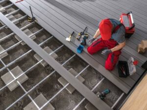
Patio expansions usually push toward the edges of a site. That’s where the risk sits, because edges are where property lines, sidewalks, parking, and utility strips meet. A plat of survey shows those edges clearly, so you’re working from measured facts instead of a fence line or an old sketch.
Many restaurant owners lease their space, which adds another layer. Your lease may limit where outdoor seating can go, and the landlord may want proof the patio stays inside the leased area. A current survey gives both sides the same picture and cuts down on back-and-forth.
Older surveys can help, but they may miss recent changes. New curbs, added dumpster pads, or widened drive aisles can shift what’s actually on the ground. Ask your surveyor whether an existing plat can be updated or whether a new one makes more sense.
Property Lines, Easements, and Existing Improvements to Review
Three items deserve a close look before any patio sketch gets finalized. Each one can move the patio footprint, change its shape, or stop the project. Here’s what to check on the plat.
Property lines and setbacks, since local rules may require the patio to sit a set distance back from the boundary. Easements for utilities, drainage, or access, which give others the right to use part of the property. Existing improvements such as parking stalls, ramps, grease traps, light poles, and dumpster enclosures.
Easements catch owners off guard more than anything else. A strip of grass beside the building may look empty, yet it could hold a recorded utility easement. If a patio covers that strip, the utility may have the right to remove it for repairs, and you could carry the cost of rebuilding.
Parking is another common conflict. Turning stalls into seating can affect the number of spaces a site must keep, and those counts vary by municipality and use. The survey shows the current stall layout, which gives your designer a solid starting point.
How Survey Information Guides Patio Site Planning
Good patio design starts with a base map, and the plat of survey often serves that role. Architects and contractors use it to place the slab, railings, shade structures, and walkways where they’ll actually fit. Working from measured data means fewer surprises once crews arrive.
The survey also helps with traffic flow. Servers need a clear path from the kitchen to the tables, and guests need safe access from the parking lot or sidewalk. Seeing doors, ramps, and grade changes on the drawing makes it easier to plan routes that work for everyone.
Share the plat with your whole team early. Your designer, contractor, and any engineer should all work from the same document. That simple step can prevent costly redesigns after a permit comment comes back.
When Topographic and Boundary Survey Data May Be Needed
A basic plat of survey covers boundaries and visible improvements, but some patio projects need more detail. Topographic data shows ground elevations, slopes, and how water moves across the site. That matters if the patio changes how rain drains away from the building or toward the parking lot.
You may want topographic data added if your project includes any of the items below. Your surveyor can explain what level of detail fits your scope. These are the most common triggers.
The patio will be raised, sunken, or built on sloped ground. New paving will cover grass or other areas that currently absorb rain. Accessible ramps or level entries need to be designed. The site sits in or near a mapped flood zone.
A full boundary survey may be needed if lot lines are unclear, corner markers are missing, or a neighbor’s improvements sit close to the line. Survey names and standards vary by state, so confirm which product matches your permit and lender needs. It’s better to settle that question before design work starts.
Using Survey Information to Reduce Permitting and Construction Risks
Permit reviewers often want to see the patio drawn on an accurate site plan. Many jurisdictions ask for a survey or survey-based plan with the application, though requirements vary by city, county, and project scope. Having one ready can shorten review and reduce requests for more information.
The survey protects you during construction too. A surveyor can stake the patio corners or key lines in the field, so the contractor builds in the approved spot. That’s a small cost compared to tearing out a slab that crossed a setback or landed on an easement.
Keep a copy of the final survey with your permit records and lease documents. It can help with future renovations, insurance questions, or the sale of the business. Clear records make the next project easier to plan.
Frequently Asked Questions
What is a plat of survey?
A plat of survey is a drawing made by a licensed surveyor that shows a property’s boundaries and features. It usually includes lot lines, buildings, paving, and recorded easements. The surveyor measures these in the field and checks them against deeds and records. Owners use it for permits, design, and property decisions.
Do I need a new survey if I already have an old one?
It depends on how old the survey is and what has changed since. New paving, structures, or recorded easements may not appear on an older plat. Some permit offices and lenders also set their own limits on survey age. Your surveyor can review the old plat and tell you whether an update will work.
Can I build a patio over a utility easement?
Building over an easement is often restricted, and the terms depend on the recorded document. Some easements allow light improvements, while others don’t allow any permanent structures. Even when building is allowed, the utility may be able to remove the patio for repairs. Review the easement language with your surveyor and attorney before designing.
How long does it take to get a plat of survey?
Timing depends on the property size, record research, and the surveyor’s current schedule. A simple commercial lot may take a week or two, while complex sites can take longer. Adding topographic data or staking can extend the timeline. Order the survey early if permits or an opening date depend on it.
Who should order the survey, the tenant or the landlord?
Either party can order it, but your lease may say who’s responsible. Tenants often order the survey when the patio is their project. Landlords sometimes prefer to hire their own surveyor for the whole parcel. Talk with your landlord first so the survey meets both sides’ needs.
For a free land surveying quote, call us at (954) 737-7509 or send us a message by going here.
Posted in land surveying, land surveyor | Tagged cost of land surveying, estimating the cost of land surveying, land surveying cost, land surveying cost Pembroke Pines