
When an ALTA Land Title Survey Helps Clear Closing Questions
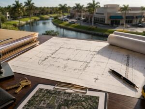
Closings fall apart for a lot of reasons. One of the most preventable is a title question nobody can answer fast enough. An ALTA Land Title Survey puts those questions on the table early, with a document that lenders, title insurers, and attorneys all accept as authoritative.
For developers working in Pembroke Pines, that matters. Broward County transactions often involve older plats, drainage easements, and canal setbacks that standard title searches miss entirely. An ALTA survey fills those gaps before they become closing-day problems.
What Makes an ALTA Land Title Survey Different
Most surveys confirm a boundary. An ALTA Land Title Survey does more. It follows standards set jointly by the American Land Title Association (ALTA) and the National Society of Professional Surveyors (NSPS).
The survey shows boundaries, yes. It also shows:
- All recorded easements and rights-of-way
- Encroachments on or from adjacent parcels
- Utilities above and below ground (where locatable)
- Setback lines from streets, canals, and wetlands
- Parking counts and access points for commercial properties
- Any visible evidence of environmental issues on site
A boundary survey shows you where the lines are. An ALTA survey tells you what comes with those lines.
Why Some Property Deals Need This Level of Detail
Pembroke Pines sits at the western edge of Broward County. A lot of the parcels there carry complications that don’t surface in a routine title search.
Canal and Drainage Easements Cross Residential and Commercial Lots
The South Florida Water Management District (SFWMD) and Broward County both maintain drainage infrastructure throughout Pembroke Pines. Easements for that infrastructure show up in recorded documents, but their exact location on a parcel often isn’t clear until a surveyor puts it on a map. An ALTA survey does that.
Build inside one of those easements without knowing its exact footprint, and you’re looking at a forced removal or a stop-work order.
Older Plats Create Title Ambiguity
Large sections of Pembroke Pines were platted in the 1970s and 1980s. Some of those recorded plats have gaps, overlapping descriptions, or utility easements that were added later without a clear recorded boundary. A lender’s title counsel reviewing a deal on one of those parcels will ask for an ALTA survey. Having it ready speeds up underwriting.
Commercial Lenders Require It
This is not optional for most commercial transactions. If a developer is financing a project in Pembroke Pines with a construction loan or permanent financing, the lender’s attorney will require an ALTA/NSPS survey before funding. Trying to close without one adds weeks to the timeline.
What an ALTA Survey Catches That Other Surveys Miss
Three things show up on ALTA surveys that routine boundary surveys don’t cover:
Utility conflicts. Underground utility locations are plotted where locatable. A developer who skips this step sometimes finds an FPL transmission line or a county force main running under the planned footprint. Relocating utilities mid-project is expensive and slow.
Access and ingress issues. An ALTA survey confirms whether legal access to the parcel matches practical access. Shared driveways, private roads, and cross-access easements need to be documented before closing. A title insurer won’t cover an access dispute that the survey would have caught.
Zoning setback conflicts with existing improvements. If a structure is already on the parcel, the ALTA survey will show whether it sits inside a required setback. That matters for developers buying an existing building to renovate or tear down.
When to Order an ALTA Land Title Survey
Order one at these points in a deal:
- When commercial financing is involved. Lenders require it. Order early so it doesn’t sit on the critical path.
- When the parcel borders a canal, wetland, or drainage right-of-way. Setbacks from those features need to be mapped, not estimated.
- When the title commitment shows Schedule B exceptions you can’t explain. An ALTA survey often resolves them or shows they’re not an issue on the ground.
- When the parcel has multiple recorded easements. You need to know where all of them run before you design anything.
- When you’re acquiring a property with existing structures. Know what’s in compliance before you own the problem.
How Long It Takes and What It Costs
Turnaround time for an ALTA survey in Broward County runs two to four weeks for most parcels. Large or complex properties with multiple easements or irregular boundaries can take longer.
Cost varies by parcel size and complexity. A typical commercial parcel in Pembroke Pines runs between $2,500 and $6,000 for an ALTA survey. Larger parcels or those with extensive utility coordination cost more. Confirm pricing directly with a licensed Florida surveyor.
ALTA surveys are valid for six months for most lending purposes under standard ALTA requirements. After that, lenders typically require a recertification or a new survey.
One note: only a licensed Professional Surveyor and Mapper (PSM) can produce an ALTA survey in Florida. Verify the surveyor’s license at the Florida Department of Business and Professional Regulation (DBPR) before signing an engagement.
Frequently Asked Questions
What is an ALTA Land Title Survey?
An ALTA Land Title Survey is a detailed survey that meets standards set by the American Land Title Association and the National Society of Professional Surveyors. It shows boundaries, easements, encroachments, utilities, and setbacks. Commercial lenders and title insurers typically require one before closing on a commercial property.
Is an ALTA survey required in Florida?
Florida law doesn’t require one for every transaction. For commercial financing, most lenders require it as a loan condition. Title insurers often require one to remove certain Schedule B exceptions from a title policy. For residential transactions, a standard boundary survey may be enough, but an ALTA survey provides significantly more protection.
How is an ALTA survey different from a boundary survey?
A boundary survey establishes the legal limits of a parcel. An ALTA survey does that and adds easements, encroachments, utility locations, setback lines, and other details required by lenders and title companies. The ALTA/NSPS standards specify exactly what must be shown, so the format is consistent across the country.
How long does an ALTA survey take in Pembroke Pines?
Most ALTA surveys in Broward County take two to four weeks from the order date. Complex parcels with multiple easements, canal frontage, or prior survey discrepancies may take longer. Budget for this in your closing timeline so it doesn’t delay funding.
Can I use an existing ALTA survey when buying a property?
It depends on how old it is. Most lenders accept an ALTA survey that is less than six months old if it can be recertified to the new buyer and lender. Recertification means the surveyor reviews the title commitment and confirms nothing has changed on the ground. If the survey is older, or if conditions have changed, a new survey is the safer choice.