
Land Surveying Before Widening or Adding a Driveway
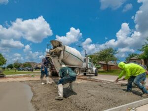
A few extra feet of concrete seems like a small job. Pour it in the wrong spot, though, and it can end up on a neighbor’s lot, over a utility easement, or inside the public right-of-way. Land surveying shows you where those lines fall before anyone breaks ground, which costs far less than finding out after the forms are set.
This guide is mainly for homeowners planning to widen a driveway or add a second one. Contractors, designers, and small commercial property owners will find it useful too. The short version is simple: get a current survey early, share it with everyone on the project, and confirm what your permit office needs before you finalize the design.
Why Surveying Matters Before Changing a Driveway
A survey tells you where you’re allowed to build and what’s already on the ground. A licensed surveyor locates your property corners, measures the lot, and maps features like the house, fences, trees, and utilities. That drawing becomes the base for every decision about driveway size, shape, and location.
Many owners rely on the old survey from their closing packet. It may be years out of date and miss a pool, shed, or fence added since. It also may not include elevations, which matter a lot for drainage around new pavement.
Guessing from a fence line is how disputes start. Fences are often off by inches or even feet. A fresh boundary survey removes the guesswork and gives your contractor fixed points to measure from.
Checking Property Boundaries, Easements, and Right-of-Way Limits
Before you design anything, you need to know three limits. These are your property lines, any easements, and the edge of the public right-of-way. A boundary survey can usually show all three on one drawing.
Property Lines and Setbacks
Your property line is the legal edge of your lot. Many codes also set minimum distances between a driveway and the side lot line, so a driveway can sit fully on your land and still break a rule. Setback rules vary by municipality, zoning district, and sometimes the recorded subdivision plat, so check them for your own lot.
Easements
An easement gives someone else the right to use part of your land for a set purpose. Utility easements are common along the front and rear of residential lots. Paving over one may be allowed in some cases, but the utility can often dig it up for repairs without replacing your concrete. Your surveyor can show easements from the plat and the title documents you provide.
Right-of-Way Limits
The right-of-way is the strip of public land along the street. It often includes the sidewalk, the swale, and a few feet of grass that looks like part of your yard. Work inside it, including a new or wider driveway apron, usually needs approval from the agency that controls the road.
Using Site Conditions to Plan Driveway Placement and Design
Where a driveway can legally go is only half the question. Where it should go depends on slope, drainage, trees, and utilities. A topographic survey maps these conditions with elevations so the design works on the actual ground.
Drainage matters most on flat lots. New concrete sheds water faster than grass, and a small grade change can send runoff toward your garage or your neighbor’s yard. Spot elevations help a designer set the slope so water flows toward the street or a swale and away from the house.
Other site features to review include:
- Trees whose roots could be damaged during excavation or could lift pavement later
- Water meters, cleanouts, irrigation lines, and utility boxes near the new edge
- Existing curb cuts, drainage inlets, and sidewalk joints
- Sight lines for backing out safely, especially near corners
If your lot is in a mapped flood zone or near a pond, canal, or retention area, ask whether added paving triggers any drainage rules. Requirements differ by property and jurisdiction. Your permit office can tell you what data it needs, and your surveyor can tell you how to provide it.
Survey Information Architects and Contractors Need for Construction
Designers and contractors need accurate measurements to draw plans, price the work, and build in the right spot. A construction survey gives everyone the same starting point. Ask for a digital file along with the signed copy if your designer will draw on it.
For most driveway projects, useful data includes:
- Boundary lines with found or set corner markers
- Recorded easements and the right-of-way line
- The house footprint, existing driveway, walks, and other improvements
- Spot elevations or contours around the work area
- Visible utilities, drainage structures, and nearby trees
Once plans are approved, some owners also hire a surveyor for construction staking. Staking places marked stakes on the ground that show driveway edges or key grades. It costs much less than tearing out concrete that landed a foot over the line.
Reducing Permitting, Construction, and Property Due Diligence Risks
A current survey helps the permit reviewer see exactly what you’re proposing. Many permit offices ask for a survey or site plan with a driveway application, though rules vary by municipality, county, and project scope. Check before you order so the survey includes what they want. If you have an HOA, get its written approval too, since many associations set their own width and material rules.
Think about a future sale as well. A driveway that crosses a lot line or sits in an easement can surface during a buyer’s survey or title review. That can slow a closing or lead to a demand for repairs.
This article isn’t legal advice. If a survey reveals an encroachment or disputed line, talk with a real estate attorney or your title company. Your surveyor can explain what they found, and the attorney can explain your options.
Frequently Asked Questions
Do I need a survey to widen my driveway?
It depends on your permit office, HOA, and project scope. Many permit offices ask for a survey or site plan with a driveway application, but not all do. Even when it isn’t required, a survey is the most reliable way to avoid building over a line or easement. Call your permit office before you apply so you know what they expect.
Can I use the survey from when I bought my home?
Sometimes, if nothing has changed and the reviewer accepts it. Older surveys may miss newer fences, pools, or additions, and they often lack elevations. Some offices want a survey that reflects current conditions. Ask your surveyor whether an update is possible, since it may cost less than a new survey.
What’s the difference between a boundary survey and a topographic survey?
A boundary survey locates your property lines and corners. It often shows improvements, the right-of-way line, and easements from the records provided. A topographic survey maps the ground surface with elevations, which helps with drainage and grading. Many driveway projects use a boundary survey with added spot elevations.
Can I build a driveway over a utility easement?
It depends on the easement terms and who holds it. Some easements allow paving, while others restrict it or require permission. Even where paving is allowed, the utility may remove it for repairs without replacing it. Review the recorded easement and check with the holder or your permit office first.
How long does a driveway survey take?
Timing depends on the surveyor’s schedule, lot size, and survey type. Fieldwork on a typical residential lot is often quick, but research and drafting add time. Busy seasons can push schedules out further. Order the survey as soon as you commit to the project so it doesn’t delay permits or your contractor.
For a free land surveying quote, call us at (954) 737-7509 or send us a message by going here.
Posted in land surveying, land surveyor | Tagged cost of land surveying, estimating the cost of land surveying, land surveying cost, land surveying cost Pembroke Pines