
Why an Elevation Survey Matters Before Regrading
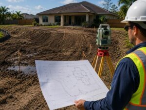
An elevation survey can stop a regrading project from creating a drainage problem that didn’t exist before. Developers sometimes treat regrading as a simple dirt-moving job. It isn’t. Without accurate elevation data, a regrading plan can redirect water toward a building instead of away from it, and that mistake is expensive to fix once the work is done.
Here’s why an elevation survey needs to come first, and what it protects you from.
How Existing Grade Breaks Can Change the Entire Regrading Plan
A grade break is a point where the slope of the land changes direction or steepness. These breaks aren’t always visible to the eye, especially on a site that looks mostly flat. An elevation survey maps them precisely, showing exactly where the land shifts from a mild slope to a steeper one, or where it flattens out entirely.
Regrading without this data risks working against the land’s natural shape instead of with it. A crew might smooth over a grade break that was actually helping move water away from a structure, creating a flatter area that now holds water instead of draining it.
What to do:
- Get an elevation survey that specifically marks all existing grade breaks on the site.
- Review the survey with your grading contractor before any equipment moves dirt.
- Preserve grade breaks that are already directing water in a safe direction.
Why Small Elevation Differences Can Redirect Water Toward Structures
A difference of just a few inches in elevation can completely change where water flows during a heavy rain. Developers sometimes assume small elevation changes don’t matter much. On a regrading project, they matter more than almost anything else.
Water follows the path of least resistance. If a regrading plan raises one section of a yard by even a small amount without accounting for the surrounding elevation, water that used to flow away from a building can start pooling against a foundation instead.
What to do:
- Use precise elevation survey data, not visual estimation, when planning grade changes near any structure.
- Model how water will move after the regrade, not just how the land will look.
- Keep a minimum slope away from foundations as required by local building code.
How Low Points Near Slabs Reveal Future Drainage Problems
A low point near a concrete slab, whether it’s a driveway, patio, or foundation, is often where drainage problems start. These low points don’t always show up until after a heavy rain, when water pools somewhere it shouldn’t. An elevation survey conducted before regrading identifies these low points ahead of time, while they’re still cheap to fix.
Ignoring a low point during regrading doesn’t make it go away. It just buries the problem under new fill, where it tends to resurface later as standing water or slab settling.
What to do:
- Ask the surveyor to specifically flag any low point within several feet of a slab or foundation.
- Address identified low points during the regrade, not after.
- Confirm final grade slopes away from all slabs at the minimum required rate.
Why Fill Depth Should Be Based on Measured Elevation Data
Fill depth, meaning how much soil gets added to raise an area, should come from actual elevation measurements, not a rough guess based on how the site looks. Adding too little fill can leave a low spot that still collects water. Adding too much can create a new slope that sends water somewhere it didn’t go before, possibly toward a neighboring property.
An elevation survey gives the exact starting elevations needed to calculate fill depth accurately across the whole site, not just in one spot.
What to do:
- Calculate fill depth using surveyed elevation points across the entire regrading area, not a single reference point.
- Recheck elevations after fill is added to confirm the grade matches the design.
- Avoid adjusting fill depth on site without updating the plan to reflect the change.
How Regrading Without Elevation Control Can Create Neighbor Runoff Issues
Water doesn’t stop at a property line. A regrading project that raises elevation on one lot can push runoff onto a neighboring property, and that can turn into a legal dispute fast. Many jurisdictions have specific rules about altering natural drainage patterns in a way that harms an adjacent property.
An elevation survey that includes the surrounding area, not just the lot being regraded, helps confirm the new grade won’t create a runoff problem for the property next door.
What to do:
- Request elevation data that extends slightly beyond your property line, not just the lot itself.
- Check local drainage alteration rules before finalizing a regrading plan.
- Document pre and post regrade elevations in case a neighbor dispute comes up later.
What This Means for Your Next Regrading Project
An elevation survey gives a regrading project the data it needs to avoid creating new drainage problems. Grade breaks, small elevation shifts, low points near slabs, fill depth, and neighbor runoff all depend on accurate measurement before the work begins. Get the survey first, plan the grade changes around real data, and confirm the results once fill is in place. It’s far cheaper than fixing a flooded foundation or a runoff dispute after the fact.
Frequently Asked Questions
How is an elevation survey different from a standard boundary survey?
An elevation survey measures the height and slope of the land at specific points, while a boundary survey confirms property lines. Regrading projects usually need elevation data, not just boundary information.
Can regrading be done without an elevation survey if the site looks flat?
It is risky. Sites that look flat often still have small grade breaks or low points that are not visible without measurement, and those hidden features can cause drainage issues after regrading.
How often should elevation data be rechecked during a regrading project?
Many contractors recheck elevations after fill is added and again once final grading is complete to confirm the site matches the planned drainage pattern.
What happens if regrading redirects water onto a neighboring property?
This can lead to a legal dispute. In many areas, changing natural drainage in a way that harms a neighbor’s property may violate local drainage regulations.
Does an elevation survey account for how water will move after heavy rain, or just the current slope?
A good elevation survey provides the data needed to model water flow after rain, although the actual flow modeling is often a separate step done by an engineer using that data.
For a free land surveying quote, call us at (954) 737-7509 or send us a message by going here.
Posted in land surveying, land surveyor | Tagged Elevation Survey